How to check haul road gradient before you commit a blade route
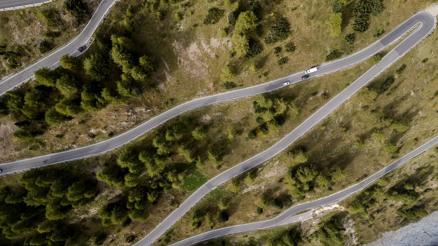
A blade transporter on a modern grade allowance can usually handle up to 8-10% for short pitches, less on sustained climbs, and almost nothing extra once you're on a switchback with a tight bend radius stacked on top of the grade. The spec sheet gives you the transporter's number. What it doesn't give you is whether the access road to your turbine pad holds below that number for its full length, or whether there's a 400 m pitch near the substation tie-in that nobody flagged because the county road database calls it "unpaved, maintained."
That's the gap that sends a pilot car down a route a desk check should have killed.
Where the grade number comes from
Most route packages start life as a GIS layer: county road centerlines, maybe a DEM-derived slope overlay, cross-referenced against the OEM's maximum grade and the carrier's rig configuration. That's a reasonable first pass, and it's usually right for the obvious stuff, state highways, paved county roads, anything with recent survey data behind it.
It falls apart on the last few miles. The segment from the public road to the pad is frequently a farm lane, a logging spur, or a road the developer cut six months ago and never submitted for county records. DEM resolution in a lot of U.S. county and rural datasets sits at 10 m or coarser, which smooths out exactly the short, steep pitches that break a haul plan: a 150 m climb out of a creek crossing, a grade change at a switchback where the road banks into the turn. A 10 m DEM averages that pitch into the surrounding terrain and reports a grade that's a few points lower than what's really there on the ground.
Imagery at sub-meter resolution lets you trace the road's alignment, see where it climbs and where it bends, and flag the segments where grade and curve radius work against the transporter at the same time. That combination is what stops a load on a switchback, more than grade by itself.
What a grade check before mobilisation should rule out
Before a haul plan gets written up for a transformer or a blade set, there are a handful of things worth confirming from a desk, not from a truck:
- Sustained climbs near the pad access. The last half-mile to a turbine pad is often the steepest segment on the whole route, cut for construction access rather than freight movement, and it's the segment most likely to be missing from any road database.
- Grade stacked on a bend. A transporter can usually take a grade, or a bend, but the combination tightens the margin fast, especially on a multi-axle blade trailer where the rear dolly has to track through the turn while the tractor is still fighting the climb.
- Approach and departure angles at creek crossings or culverts. A grade change that's fine for a pickup truck can ground out a low-boy with a nacelle on it.
- Braking distance on the descent. The same climb that strains the tractor going up is the one that needs retarder capacity and a clear runout going down, particularly loaded.
None of this replaces a physical route survey. It replaces sending the survey crew down a route that an imagery-based grade read would have ruled out before anyone booked a hotel near the site.
That's the logic behind a route-and-site constructability read run from VHR imagery before the haul plan gets committed: check road width, bend radii, bridge spans, gradient and laydown space against the transporter and the turbine package you're moving, before the pilot car finds out the hard way.
If you've got a route you're about to sign off on, that's the check worth running first.