Field notes: the switchback that didn't show up until we zoomed in twice
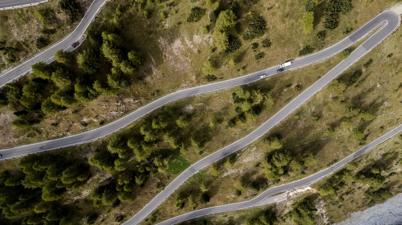
We were screening a route for a transformer delivery into a wind site in hill country, the kind of terrain where the access road was never built with a 48-wheel platform trailer in mind. First look at the imagery, the route read fine. Gravel road, a few curves, nothing that jumped out as a problem. The kind of route that gets a checkmark and moves to the next item on the list.
Then we zoomed in for the laydown area near the substation pad, just to confirm there was enough flat ground for the crane to set up. And there it was, tucked behind a stand of trees that had been reading as a single dark mass at the first zoom level: a switchback climbing the last 200 meters to the pad, with a radius that no tool we know of would clear fully loaded.
At the zoom level most people stop at, that stretch of road just looks like road. The curve doesn't register until you're close enough that the pixel count actually resolves the bend, and that's a different zoom than the one you'd use to check gradient across the whole route or confirm the bridge spans upstream. Three different problems, three different zoom levels, and if you only do one pass you'll catch two of them and miss the third.
This is the part of route screening that doesn't make it into the planning meeting until it's too late: constructability problems don't all sit at the same scale. A bridge span issue is visible zoomed way out, you can see the whole crossing and measure it against the trailer's deck length. A gradient problem shows up in the terrain data, not really a zoom question at all. But a tight switchback, especially one buried in tree cover or shadow, only shows up when you're close enough to trace the actual curve of the road edge against the centerline. Zoom out and it blends into the vegetation. Zoom to the wrong spot and you're looking at the wrong 200 meters of road.
We've started treating this as a standard part of the pass now: one look at the full route for the big stuff, span widths, overall gradient, obvious pinch points, and then a second, closer look specifically along anything that bends, because a road can hide a bad curve behind foliage the same way it hides a culvert. The habit that catches it is boring and a little repetitive. Trace every bend twice. It's the kind of thing a pilot car survey would eventually find too, at the cost of a truck, a crew, and a day, parked at the base of a switchback that was never going to work, radioing back that the route needs rerouting.
The frustrating thing about that particular hairpin is that it would have been cheap to catch on paper. Nobody walked that stretch of road before the haul plan went out, because the stretch of road looked like every other stretch of road from a normal working zoom. It took a second pass, closer in, on a section that had already been mentally filed as "fine," to find the one curve that would have turned a scheduled delivery into a stranded convoy and a very unhappy call to the site.
That's the real case for running a route through a desk-level constructability read before a haul plan gets committed. The obvious stuff, road width, bridge spans, tends to get checked already, because everyone knows to look for it. The bend radii tucked behind a tree line are the ones that stay invisible, because they only show up at a zoom level nobody naturally stops at.
We'd rather find the switchback on a screen before the haul plan gets committed than find it with a truck. If your next route has a bend you haven't traced twice yet, that's exactly what a constructability screening is for.