Field notes: the roundabout that looked fine on the map and wasn't
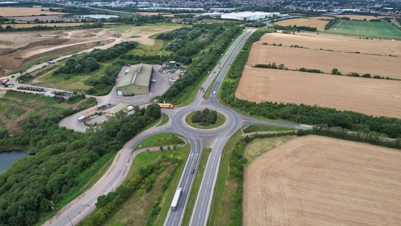
There's a roundabout about four miles off the interstate, on the way into a substation site, that every routing engineer who's touched this corridor has an opinion about. On paper it's unremarkable. Single lane, mountable apron, splitter islands on three of the four legs, nothing that trips a red flag in a standard swept-path run. The centerline radius checks out. The approach angles check out. If you pulled it up cold and ran it against a generic 53-footer, you'd wave it through and move to the next leg.
Eighteen inches off the apron edge sits the real trouble.
Somebody put a landscaped median strip with a raised concrete curb and a cluster of ornamental lighting right where a blade trailer's outside wheel track wants to go on the wide-radius sweep. A standard load clears it clean. A 165-foot blade on a steerable dolly, taking the long way around because the inside track can't clear the splitter island on that approach, does not. The truncated domes at the pedestrian crossing on the far leg don't help either. They're rated fine for foot traffic and not built to take a loaded axle group at low speed without cracking.
None of that shows up as a geometry failure in the usual sense. The roundabout does what a roundabout is supposed to do. It just wasn't built with the idea that someday a transformer or a blade set would need to swing wide through it, and nothing about its listed dimensions tells you that until you're standing there with a tape measure, or worse, until a pilot car calls back from the junction saying the load can't make the turn.
This is the gap that a desk check closes if you're looking at the right things. Intersection geometry for an oversize load means more than lane width. It covers whether the swept path of the actual configuration, at the actual approach angle, clears everything fixed within that path: curbs, islands, signal poles, drainage structures, landscaping nobody thought to flag because it's not infrastructure in the sense a GIS layer usually cares about. A route that passes a generic truck-turn template can still fail for the specific combination of trailer type, cargo length, and axle spread you're moving. The roundabout was never the issue. The assumption that "roundabout, checked" was a complete answer was the issue.
The expensive way to find this out is to find it out on the day. A pilot car survey that discovers a median strip problem at a live roundabout, with a convoy already staged and a permit window already ticking, turns into a re-route decision made under pressure, with everyone standing around while someone calls the DOT contact to ask about a temporary curb removal. The survey itself does its job fine. A static geometry conflict like this one is a bad fit for catching on the day with a pilot car, the kind of thing a careful read of the site beforehand flags weeks earlier, cheap, with time to fix the route instead of patch it on the fly.
What we do now is treat the roundabout, and every tight bend, bridge approach, and laydown pad on a route, as something to screen before the haul plan locks, not after a pilot car finds out the hard way. That's the idea behind running a route through a constructability check before mobilisation: a read of road width, bend radii, bridge spans, gradients, and clearance against what the load actually needs, done from imagery before anyone commits a pilot car to the road.
The roundabout is still there, by the way. It's just not a surprise anymore.
If your next route has a roundabout, a bend, or a laydown pad you'd rather not find out about on moving day, that's what Constructability Screening is for.